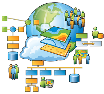
Geographic information systems
OPTIMIZE YOUR DELIVERY AND SALES OPERATIONS
What is GIS?
A geographic information system (GIS) is a computer system for capturing, storing, checking, and displaying data related to positions on Earth's surface. GIS can show many different kinds of data on one map. This enables people to more easily see, analyze, and understand patterns and relationships.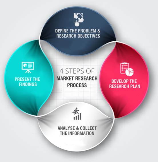
Geo-Market Research
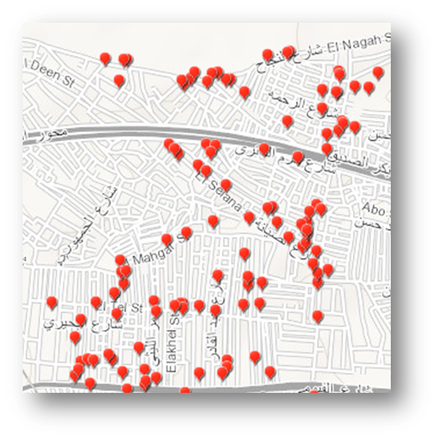
For every FMCG & Distribution Companies, we can support you byWe are providing a wide variety of in field marketing research services in Egypt including
retail census
In shop research
Consumer research
Using the latest technology with guaranteed accuracy and after sales services.
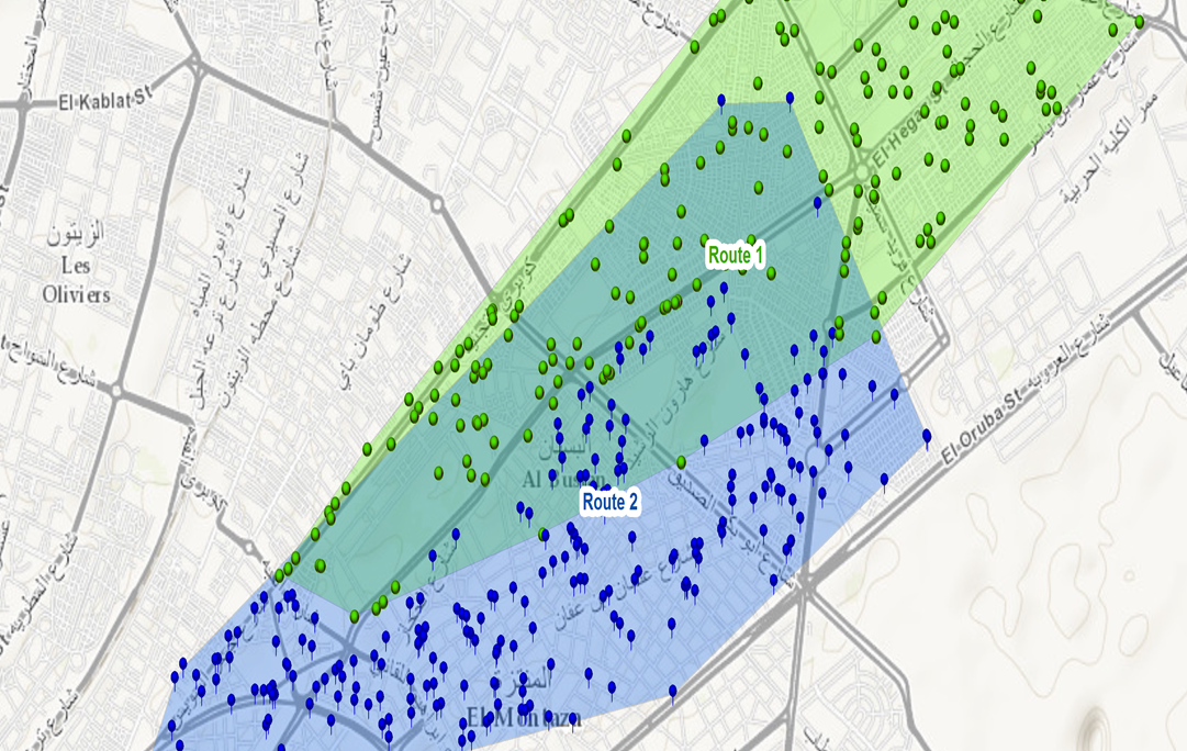
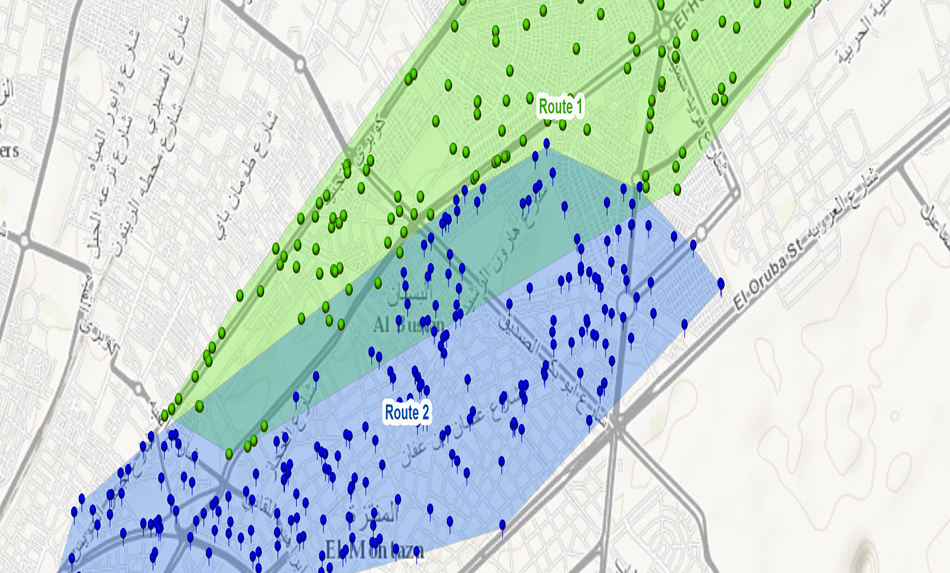
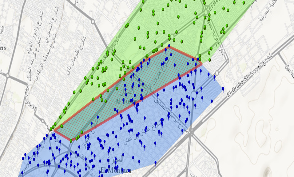
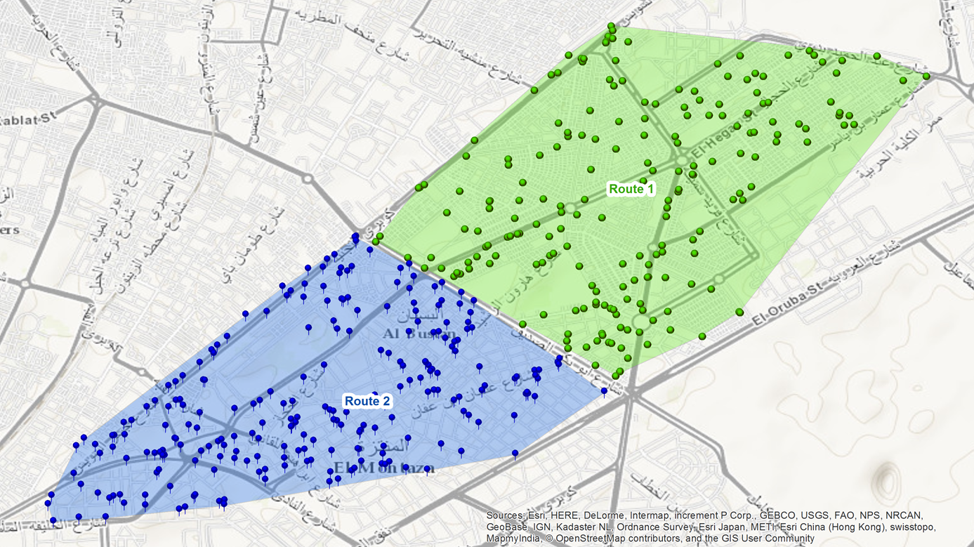
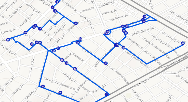
Rerouting
Enrich your distribution system to be a very effective and efficient by
01
Eliminate overlap.
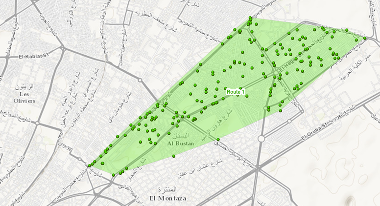
02
Build a very effective daily route plan to meet the opportunities.
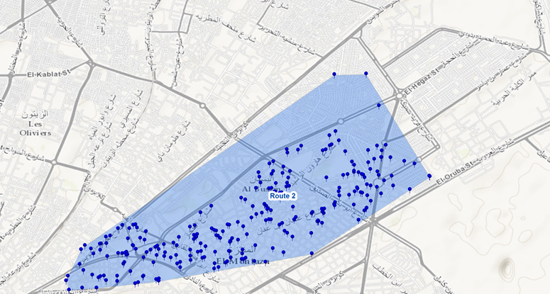
03
Create the shortest path of your route plan stops with effective sequence.
04
Reduce in market travel time up to 30% - 40%.
05
Improve your KPIs (Effective Calls, Strike Rate ).
06
Balance the workload ( # POSs , Sales , Working hours)
07
Achieve your goals (Sales & Distribution Effectiveness).
Geo-Coding
converting the regular address (Street – Area- District- Governorate) into geographical location.Mandatory Process in GIS
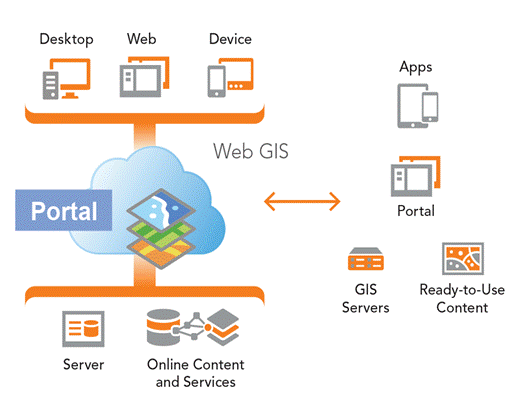
Web Development
Bring your data to life with full interactivity maps
Get your GIS information on your device on any time
Enrich your data with multiple views and graphs
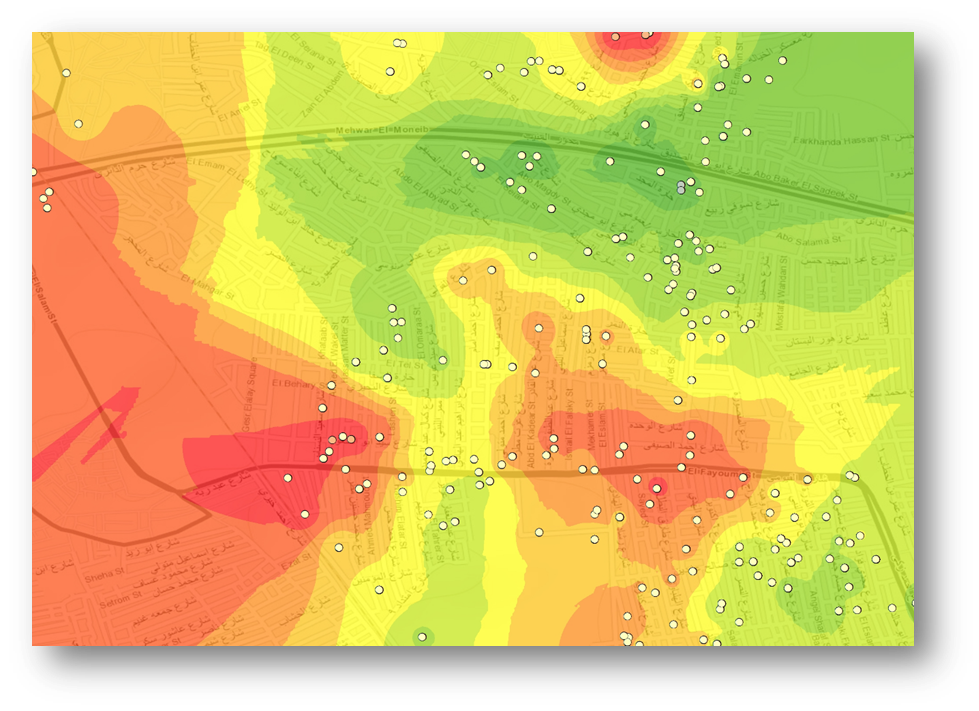 Your Sales Hot spot areas
GIS Analysis
We will analyze your data to get you the most useful spatial insights.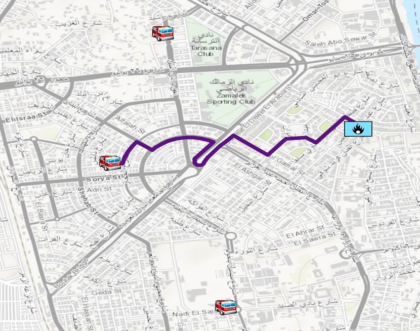
Closest facility analysis
Multiple situation analysis likeThe nearest super market from your chain should fulfill a new customer order.
The nearest fire station to fire incident and provide the shortest path.
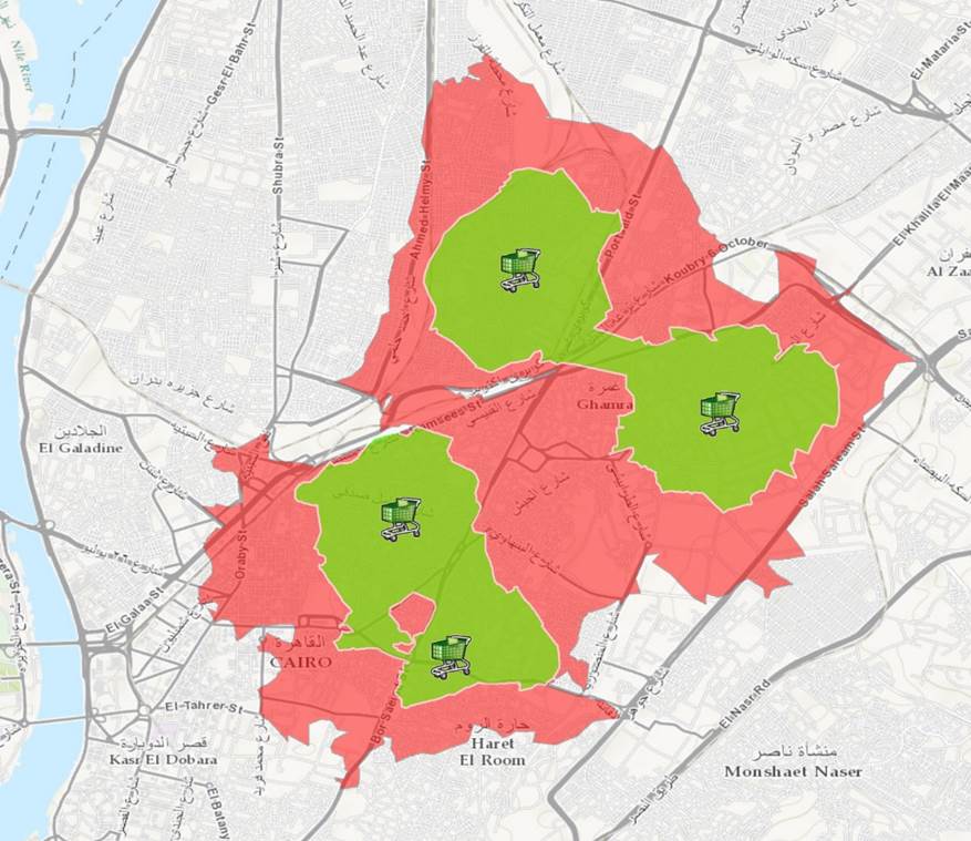
Services coverage Areas
Distribution centers coverage areas within 10 km to 20 km drive-time helps locating shortage areas and future expansions.Cartography
The best way to represent your data in one beautiful view to get the most insightful information's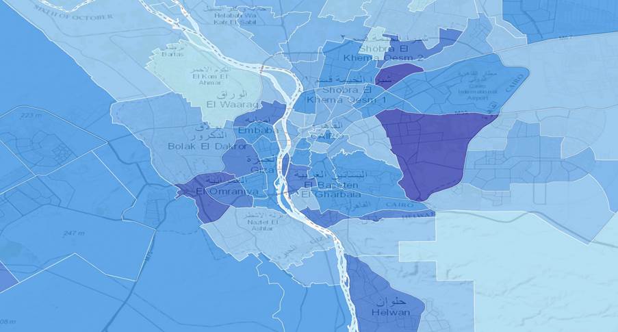 Population Density per area
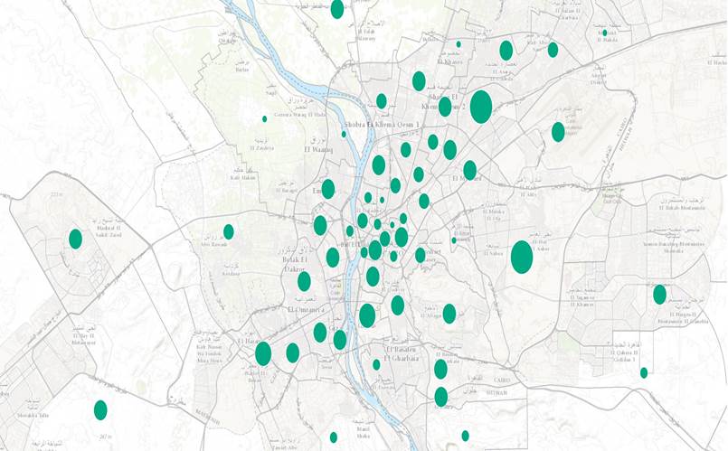 Points of interest concentration per area as size graduated symbols